
Low-Altitude Multi-Role UAV
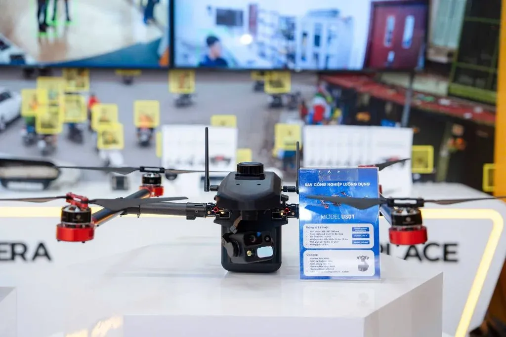
A tactical low-altitude aerial reconnaissance solution — helping ground forces gain an overall view, patrol borders, carry out search and rescue and keep track of situations in real time.
Highlights
What sets it apart.
3-axis stabilised gimbal camera with optical zoom, transmitting HD imagery to the command centre
Holds a stable position in wind and hovers automatically if the control signal is lost
Returns automatically to the take-off point when the battery is low or the signal is lost
Waypoint flight planning and automated patrol routes
Overview
Low-Altitude Multi-Role UAV
Complementing fixed camera systems
Fixed cameras can only see where they are installed. The UAV fills precisely that gap: observing areas without infrastructure, complex terrain, or unexpected situations outside the coverage area.
Three safety mechanisms
Because the aircraft operates above people and property, its safety mechanisms are as important as its observation capabilities:
- GPS position hold — stays steady in wind and does not drift out of the observation area
- Auto-hover on signal loss — does not free-fall, but waits for the connection to be restored
- Return to take-off point — triggered when the battery is low or contact is lost for an extended period
Legal notes
Unmanned aircraft flight operations in Vietnam are subject to regulations on flight permits and airspace management. NST provides the device’s technical documentation to support the operator’s flight permit application.
Specifications
Technical specifications.
- Observation payload
- 3-axis stabilised gimbal, optical zoom
- Image transmission
- Real-time HD to the command centre
- Safety features
- Auto-hover on signal loss, auto-return on low battery
- Flight modes
- Waypoint planning, route automation
- Flight time
- To be updated
- Operating radius
- To be updated
- Payload
- To be updated
Detailed specifications are provided in the official technical documentation. Call +84 912 211 467 for the full version.
Use cases
Where it is deployed.
- Security surveillance and tactical reconnaissance
- Border patrol
- Emergency response and search and rescue
- Post-disaster damage assessment
Same product group
Aerial systems
AS01 Reconnaissance UAV
An unmanned aerial platform for reconnaissance and aerial image collection in patrol, area surveillance and search and rescue missions.
View detailsAS02 Reconnaissance UAV
An upgraded version in NST's reconnaissance UAV line, designed for missions with higher requirements for flight time, operating range and observation payload capacity.
View detailsContact
Need a solution for your organisation?
NST’s engineering team is ready to discuss your operational requirements, integration approach and deployment conditions.