
AS01 Reconnaissance UAV
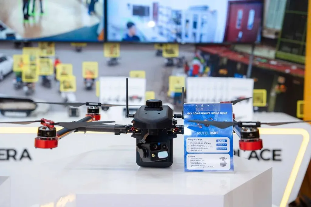
An unmanned aerial platform for reconnaissance and aerial image collection in patrol, area surveillance and search and rescue missions.
Highlights
What sets it apart.
Captures aerial imagery in real time and transmits it to the ground control station
Rapid deployment in the field, with no take-off or landing infrastructure required
Flies pre-planned routes or is flown manually as the situation requires
Records all flight data for post-mission reporting and analysis
Overview
AS01 Reconnaissance UAV
Role in the surveillance system
The UAV complements fixed camera systems exactly where they are weakest: observing areas without infrastructure, complex terrain, or unexpected situations outside the coverage area. The device is deployed per mission and does not operate on a permanent basis.
Deployment components
- Aerial platform — airframe, propulsion system and flight control system
- Observation payload — optical sensor assembly on a stabilised mount
- Ground control station — live image display, flight planning and status monitoring
- Transmission link — the image and command link between the aircraft and the station
Legal and operational notes
Unmanned aircraft flight operations in Vietnam are subject to regulations on flight permits and airspace management. NST supports the operator with the device’s technical documentation for flight permit applications under current regulations.
Specifications
Technical specifications.
- Airframe configuration
- To be updated
- Maximum flight time
- To be updated
- Operating radius
- To be updated
- Service ceiling
- To be updated
- Payload
- To be updated
- Optical sensors
- To be updated
- Permissible wind conditions
- To be updated
- Data link
- To be updated
Detailed specifications are provided in the official technical documentation. Call +84 912 211 467 for the full version.
Use cases
Where it is deployed.
- Patrol and surveillance of wide areas and hard-to-reach terrain
- Search and rescue, and assessment of natural disaster scenes
- Scene observation to support on-site command
Same product group
Aerial systems
Low-Altitude Multi-Role UAV
A tactical low-altitude aerial reconnaissance solution — helping ground forces gain an overall view, patrol borders, carry out search and rescue and keep track of situations in real time.
View detailsAS02 Reconnaissance UAV
An upgraded version in NST's reconnaissance UAV line, designed for missions with higher requirements for flight time, operating range and observation payload capacity.
View detailsContact
Need a solution for your organisation?
NST’s engineering team is ready to discuss your operational requirements, integration approach and deployment conditions.